Peru: Classic Inca Trail Day 3 – Conquering the Heights
Introduction
Day three on the Classic Inca Trail is often regarded as the most physically demanding. After two days of steady trekking, our group—consisting of me, my daughter, Anna, our guide Nick, and a dedicated team of porters and a cook—now faced the highest and most grueling point of the trail. Covering 8.7 miles, this journey would take us from the camp at Llulluchapampa to the mist-shrouded heights of Phuyupatamarca, navigating altitudes ranging from 11,630 ft (3,548 m) to a daunting 13,828 ft (4,215 m).
Accompanying us was an unexpected companion—a stray dog we named Chico—who had followed our path since Day 2 (if you missed it, [read here about our ascent to new heights]). Yet today, as we approached Dead Woman’s Pass, the highest point on the entire trail, we knew this would be the ultimate test of endurance and spirit. Each step carried the weight of not just physical challenge but a deeper personal journey, whose meaning became more profound with every ascent.
"The Final Steps of the Ascent to Dead Woman's Pass"
This image captures the steep climb to Dead Woman's Pass on the Classic Inca Trail, reaching an elevation of 13,828 ft (4,215m).
Shot with Canon EOS 6D Mark II + EF 16-35mm f/4 IS USM.
If you missed the earlier parts of this journey, catch up on the adventures that led up to the Inca Trail:
Morning Ascent to Dead Woman’s Pass
The day began with a steady and challenging ascent to Warmiwanusqa, known as Dead Woman’s Pass, the highest point on the Inca Trail at 13,828 ft (4215m). Named for the shape of the pass resembling a woman lying down, it stood as a significant milestone of the trek. Reaching the pass rewarded us with sweeping, panoramic views of the valleys we had just climbed. Standing at this lofty height, nearly 5,905 feet higher than Machu Picchu itself, brought a profound sense of accomplishment and awe at the natural beauty surrounding us.
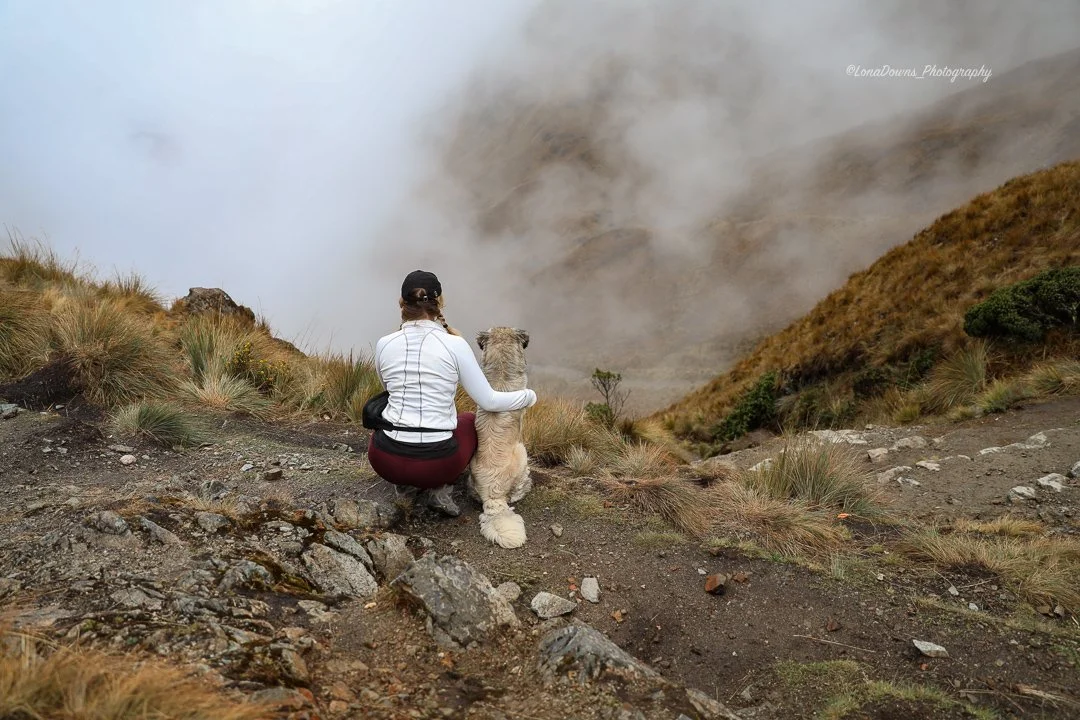
At the summit, we took a moment to catch our breath and soak in the breathtaking views, with Chico sitting silently at the top, gazing out over the valley below. It felt like a moment of reflection, capturing both the physical and emotional significance of our journey.
"Misty View from Dead Woman's Pass". Taking in the breathtaking views of Dead Woman's Pass with Chico, our unexpected trail companion. A moment of reflection,, surrounded by the beauty and solitude of the Andes. Shot captured with the CanonEOS 6D Mark II+EF 16-35mm f/4 IS USM. ©LonaDownsPhotography
"Each breath echoed the climb as I neared Dead Woman’s Pass at 13,828 feet. The highest point of the Inca Trail—earned with every step. Watch the final push below."
"Gazing Down At The Valley Below" This image, captured at the top of Dead Woman's Pass by Anna Sommer, shows a quiet moment shared between the author and Chico, the stray dog who accompanied the hike. It embodies the serene reflections of two wanderers gazing out over the Sacred Valley. Shot with a Canon EOS 5D Mark IV + EF 24-70mm f/2.8L II USM.
The Journey Continues….
After soaking in the scenery, it was time to head down toward the Pacaymayo River, where lunch awaited. The steep descent offered a welcome change after the challenging climb, unveiling new perspectives of the Andean landscape. As we continued on, thinking Chico might have stayed behind at the summit, we soon realized he wasn’t done with us yet. As we rounded a curve, there he was—bounding toward us with renewed energy, as if the adventure had only just begun for him. Through every ascent and descent, Chico remained by our side, licking water from the rocks and chewing on grubs from the trees. Though we offered him water from a container provided by the porters, he seemed unsure what to do or even how to drink out of it, preferring to stick to his natural sources.
Chico’s resilience and spirit added an unexpected but welcome dimension to our journey, reminding us of the wild and untamed beauty of the trail and the creatures that call it home.
The Ruins of Runkuraqay and the Second Pass
After a hearty lunch at Pacaymayo, we embarked on the next leg of our journey—a steep climb toward the ruins of Runkuraqay and the second mountain pass at 13,200 feet. The ruins provided a glimpse into the Incan legacy, their stone structures silhouetted against the majestic mountain peaks. From this high vantage point, we began a gradual descent toward Sayacmarca at 12,551 feet.
Along the way, we traversed a dry lake bed and entered a misty cloud forest, where dense foliage and swirling mist created an almost magical atmosphere. The steady ridge that followed offered a much-needed respite from the intense climbs earlier in the day. As we walked, breathtaking views of the Aobamba Valley far below unfolded before us, though the swirling mist obscured the majestic, snow-capped Mount Salkantay to the west. The ancient flagstone path laid down by the Incas centuries ago guided us through this surreal landscape.
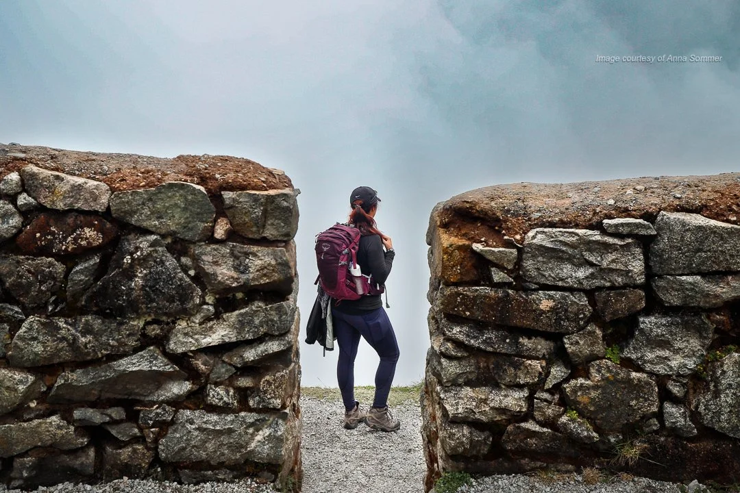
"Standing at Runkuraqay Ruins, Overlooking the Misty Valley" Article's author stands at the Runkuraqay Ruins, overlooking a mist-shrouded valley on the Classic Inca Trail. Shot by Anna Sommer. using a Canon EOS 5D Mark IV with a 24-70mm f/2.8L lens.
"Overlooking Runkuraqay Ruins from Above". High above the ancient Runkuraqay Ruins, the Inca Trail winds through the foreground, offering a stunning view of the ruins nestled in the rugged Andes. A reminder of the journey’s rich history and breathtaking beauty at every turn. Captured with the Canon 16-35mm f/4 lens.
A Rainy Descent to Phuyupatamarca
In the final hours of the day, as we descended, the weather turned. A light rain began to fall, quickly growing into a downpour that drenched everything in its path. The trail became slippery and treacherous, making it nearly impossible to capture photos. Chico, unfazed by the weather, continued to walk alongside us, his spirit seemingly undeterred by the relentless rain.
After hours of wet trekking, we arrived at Phuyupatamarca, our campsite for the night, aptly named the "place of the clouds" in Quechua. The rain-soaked tents and stormy night added an extra layer of challenge to an already demanding day. Chico found a spot nearby, curling up in the tall grass, exposed to the elements despite the downpour that soaked him to the bone.
"Trekking Through a Rainstorm on the Classic Inca Trail". Captured on Day 3, this video reveals the steep descent along the Classic Inca Trail, with rain pouring down and drenching everything in its path. The challenging conditions highlight the rugged beauty and unpredictability of the journey through these ancient mountains. This is why rain gear and a waterproof cover for backpacks are so essential.
Night Under a Stormy Sky
After a long, exhausting day, my daughter and I crawled into our rain-soaked tents, grateful for a hot meal yet aware of the storm raging outside. The relentless sound of rain pounding against the fabric was deafening, making it nearly impossible to find comfort on the sloped ground.
In the middle of the night, I had to brave the elements to visit the portable toilet. Stepping outside into the downpour, I spotted Chico huddled next to our tent, shivering in the rain. I felt a pang of sympathy for the little dog who had accompanied us through thick and thin. Despite our earlier attempts to coax him into the lunch tent—where he had seemed hesitant and afraid—we had refrained from offering him food, worried it might encourage him to continue following us. Still, it was hard not to wish for a way to provide him shelter.
Back inside the tent, my daughter and I struggled to find comfort, but we kept our spirits up by sharing jokes and stories throughout the night. Laughter helped lighten the mood as we tried to forget the storm outside, embracing the adventure—even if it was a bit miserable.
Summary of Day 3’s Journey
Distance Covered: 8.7 miles (14 km)
Starting Elevation: 11,630 feet (3,548 m)
Ending Elevation: 13,828 feet (4,215 m)
Notable Stops: Dead Woman’s Pass (Warmiwanusqa), Pacaymayo River, Runkuraqay ruins, Sayacmarca, Phuyupatamarca campsite
Highlights: Reaching Dead Woman’s Pass, the highest point on the trail; exploring the ruins of Runkuraqay; traversing misty cloud forests; Chico’s companionship; and a rainy, atmospheric descent to Phuyupatamarca.
Closing Thoughts
Day three on the Inca Trail was a remarkable test of endurance and spirit, revealing both the physical challenges and the beauty of our surroundings. Each step brought us closer to the ancient history woven into the landscape and highlighted the strength of the bonds we shared. Chico’s unwavering spirit reminded us that adventure often thrives with unexpected companions. Through the rain, struggles, and moments of laughter, we found joy in the journey, embracing the unexpected and discovering the profound beauty that lies within every adventure.
Travel Tips for the Inca Trail
Prepare for Altitude: Acclimatizing in the Sacred Valley before the trek is essential. Take your time and listen to your body to avoid altitude sickness.
Bring Waterproof Gear: The weather can be unpredictable, so pack a quality rain jacket and waterproof cover for your backpack.
Stay Hydrated: Keep water on hand and drink frequently. Consider carrying a reusable water bottle with a filter to ensure you have safe drinking water throughout the trek.
Embrace the Adventure: Not every moment will be perfect—challenges will arise along the way. Embrace the unexpected and find joy in the journey.
Photography Tips for the Inca Trail
Capture the Landscape: The Inca Trail offers stunning views. Use a wide-angle lens, such as a 16-35mm or a 24-70mm, to showcase the vast landscapes.
Document the Journey: Take candid shots of fellow trekkers and porters to capture the experience and shared moments on the trail.
Focus on Details: Zoom in on Incan stonework, local plants, or trail textures to tell a richer story of the trek.
Embrace Rainy Moments: Rain can create dramatic atmospheres in your photos. Protect your camera gear with a waterproof cover to shoot without worry!
"With the hardest part of the trail behind us, the adventure isn't over yet. Tomorrow, we'll rise early for the final push toward the majestic Machu Picchu. Stay tuned for Day 4, where history and breathtaking landscapes await—and discover Chico's fate as our journey draws to a close."
Explore More
I've been wanting to write about this journey—and others like it—for a while now, and I'm just getting started. Keep checking back for more of my adventures, and if you enjoyed this post, explore these links:
Peru: Exploring the Sacred Valley – Discover the stunning landscapes and cultural experiences before the trek.
Peru: Sacred Valley Adventures – Acclimating for the Inca Trail and what to expect.
Photographing the Frozen Landscape: Tips and Tricks from an Antarctica Expedition – Explore breathtaking experiences and my photography tips from the frozen continent.
South American Photography Gallery – A collection of my favorite images from my travels across South America.


